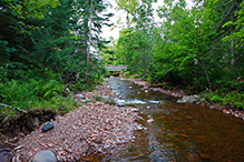
Kodonce River State Wayside
About • Location • Activities • Ecology
About |
||
Ownership |
||
|
||
Links |
||
Overview |
||
|
||
History |
||
|
||
Management |
||
|
||
Comments |
||
|
||
Location |
||||
Maps |
||||
|
||||
Printable Map(s) with GPS coordinates |
||||
Size |
||||
131 acres |
||||
Parking |
||||
N47 47.638, W90 9.241 |
||||
Hours |
||||
Parking limit six hours. Overnight parking is not allowed. |
||||
Fees |
||||
No fee (?) |
||||
Driving Directions |
 |
|||||
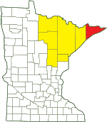
| Cook County | ||||||
| Northeast Minnesota | ||||||
Activities |
||
Hiking Trails |
||
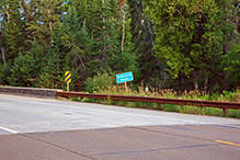
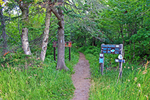
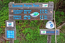
Kodonce River State Wayside is an access point to the Superior Hiking Trail (SHT). Park at the paved parking area on the south side of MN 61. On the north side of the highway there is a sign for the SHT. The trail here is a spur for the SHT, leading 0.6 miles north to the main trail. There are 1.3 miles of trails in this wayside. Most of that is on the Superior Hiking Trail. |
||
Hunting |
||
No hunting |
||
Ecology |
|||||||
Ecological Classification |
 |
||||||
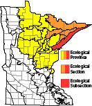
| Ecological Province | Laurentian Mixed Forest Province |
||||||
| Ecological Section | Northern Superior Uplands |
||||||
| Ecological Subsection | North Shore Highlands |
||||||
| Land Type Association | North Shore Till Plain |
||||||
Native Plant Communities* |
|||||||
Aspen - Birch Forest, Balsam Fir Subtype Bedrock/Boulder Shore (River) Cliff/Talus System Gravel/Cobble Beach (Lake Superior) Northern Mesic Mixed Forest Upland White Cedar Forest |
|||||||
| * Source: The Minnesota Biological Survey, Minnesota Department of Natural Resources, Division of Ecological Resources | |||||||
Natural Features |
|||||||
|
|||||||
What’s In a Name?
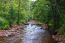
On April 1, 1947, this site was officially designated Kodonce River State Park. In 1969 it was demoted and renamed Kodonce River State Wayside. It is often referred to as “Kadunce River State Wayside,” even in Minnesota DNR news releases. It protects the last mile of a gorge where Kadunce Creek (also called Kadunce River) drops 300 feet and empties into Lake Superior. The area is mapped on the USGS Kadunce River quad. The original name may have been an alternate spelling or a misspelling, but it remains the official name of the site.

Slideshows |
||
| Paula Schlotec kadunce river crew (guss lives) |
||
About
Published on Jul 14, 2012 trip up the kadunce river in Grand Marais, MN 7/13/2012 |
||
Visitor Videos |
|||
Share your video of this destination. |
|||
| This button not working for you? Simply email us at info@MinnesotaSeasons.com. Attach a video, a YouTube link, or a cloud storage link. |
|||
Other Videos |
|||
| Kadunce normano1 |
|||
About
Uploaded on Aug 26, 2008 Walk up the Kadunce River. |
|||
| Kadunce River w/Ellie & Jeremy Sarah Reller |
|||
About
Published on Aug 13, 2013 No description available. |
|||
| Kadunce Canyoneering Bryan Hansel |
|||
About
Uploaded on Jun 21, 2009 Canyoneering the Kadunce River in NE MN. |
|||

Visitor Sightings |
||||||||||||||||||||||||||||||||
Share your sightings or comments about of this destination. |
||||||||||||||||||||||||||||||||
| This button not working for you? Simply email us at info@MinnesotaSeasons.com. |
||||||||||||||||||||||||||||||||
MinnesotaSeasons.com Sightings |
||||||||||||||||||||||||||||||||
|
||||||||||||||||||||||||||||||||
Birds |
||||||||||||||||||||||||||||||||
|
||||||||||||||||||||||||||||||||
Fishes |
||||||||||||||||||||||||||||||||
Fungi and Lichens |
||||||||||||||||||||||||||||||||
|
||||||||||||||||||||||||||||||||
Insects and Arachnids |
||||||||||||||||||||||||||||||||
Plants |
||||||||||||||||||||||||||||||||
|
||||||||||||||||||||||||||||||||
Minnesota Biodiversity Atlas and Minnesota Biological Survey Vegetation Releves Plant List |
||||||||||||||||||||||||||||||||
Plants frequently found in: Aspen - Birch Forest: Balsam Fir Subtype FDn43b1 Bedrock/Boulder Shore (River) RVx43a Cliff/Talus System CT Gravel/Cobble Beach (Lake Superior) LKu32e |
||||||||||||||||||||||||||||||||
Last Updated:
