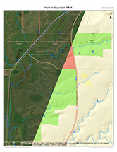
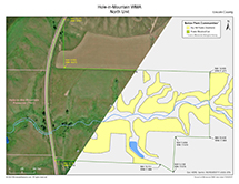
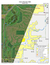
Hole-in-Mountain WMA
About • Location • Activities • Ecology
About |
||
Ownership |
||
|
||
Links |
||
Overview |
||
|
||
History |
||
|
||
Management |
||
|
||
Comments |
||
|
||
Driving Directions |
 |
|||||
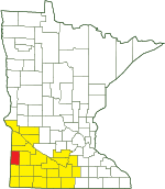
| Lincoln County | ||||||
| Southwest Minnesota | ||||||
Activities |
||
Hiking Trails |
||
No maintained trails |
||
Hunting |
||
All hunting and trapping. See Hunting and Trapping Regulations (MN DNR) for details. |
||
Ecology |
|||||||
Ecological Classification |
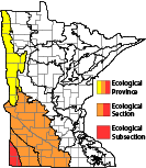 |
||||||
| Ecological Province | Prairie Parkland Province |
||||||
| Ecological Section | North Central Glaciated Plains |
||||||
| Ecological Subsection | Inner Coteau |
||||||
| Land Type Association | Trosky Till Plain Woodstock Till Plain |
||||||
Native Plant Communities* |
|||||||
Basin Meadow/Carr Cattail - Sedge Marsh (Prairie) Dry Hill Prairie (Southern) Dry Sand - Gravel Prairie (Southern) Prairie Meadow/Carr
|
|||||||
| * Source: The Minnesota Biological Survey, Minnesota Department of Natural Resources, Division of Ecological Resources | |||||||
Natural Features |
|||||||
|
|||||||
Visitor Photos |
|||||
Share your photo of this destination. |
|||||
| This button not working for you? Simply email us at info@MinnesotaSeasons.com. Attach one or more photos and, if you like, a caption. |
|||||
|
|||||
MinnesotaSeasons.com Photos |
|||||
|
|||||

Slideshows |
||
Visitor Videos |
|||
Share your video of this destination. |
|||
| This button not working for you? Simply email us at info@MinnesotaSeasons.com. Attach a video, a YouTube link, or a cloud storage link. |
|||
Other Videos |
|||

Visitor Sightings |
||||||||||||||||||||||||||||||||
Share your sightings or comments about of this destination. |
||||||||||||||||||||||||||||||||
| This button not working for you? Simply email us at info@MinnesotaSeasons.com. |
||||||||||||||||||||||||||||||||
MinnesotaSeasons.com Sightings |
||||||||||||||||||||||||||||||||
|
||||||||||||||||||||||||||||||||
Fungi and Lichens |
||||||||||||||||||||||||||||||||
Minnesota Biodiversity Atlas and Minnesota Biological Survey Vegetation Releves Plant List |
||||||||||||||||||||||||||||||||
Plants frequently found in: Cattail - Sedge Marsh (Prairie) MRp83a Dry Hill Prairie (Southern) UPs13d |
||||||||||||||||||||||||||||||||
Dakota Skipper Reintroduction
The Dakota Skipper was historically found in western Minnesota from Pipestone, Murray, and Cottonwood Counties in the south to Roseau County in the north. In the last few decades it has become extirpated from three-fourths of its documented locations nationally, including all of the locations in southwestern Minnesota. In 2017, Dakota Skippers were reintroduced into adjacent Hole-in-the-Mountain Prairie Preserve, owned by The Nature Conservancy. It is hoped that the species will eventually colonize Hole-in-Mountain WMA.
Created: Last Updated: © MinnesotaSeasons.com. All rights reserved. |

