![]()
![]()
![]()
![]()
Moose Mountain SNA
About • Location • Activities • Ecology
About |
||
Ownership |
||
|
||
Links |
||
Overview |
||
|
||
History |
||
|
||
Management |
||
|
||
Comments |
||
|
||
Location |
||||
Maps |
||||
Printable Map(s) with GPS coordinates |
||||
 |
||||
Size |
||||
177 acres |
||||
Parking |
||||
N46 52.892, W91 59.036 |
||||
Driving Directions |
 |
|||||
| St. Louis County | ||||||
| Northeast Minnesota | ||||||
Activities |
||
Hiking Trails |
||
A hiking trail leads from the parking area 200 yards uphill to a powerline clearing, then ½ mile along the clearing. Near the end of the trail a fire road can be followed back to the County Road 12 about ½ mile north of the parking area. |
||
Hunting |
||
Deer hunting only (by archery and firearm on specific dates). See Hunting and Trapping Regulations (MN DNR) for details. |
||
Ecology |
|||||||
Ecological Classification |
 |
||||||
| Ecological Province | Laurentian Mixed Forest Province |
||||||
| Ecological Section | Northern Superior Uplands |
||||||
| Ecological Subsection | North Shore Highlands |
||||||
| Land Type Association | Split Rock Till Plain |
||||||
Native Plant Communities* |
|||||||
Aspen - Birch Forest: Hardwood Subtype Aspen - Birch Woodland Black Ash - Aspen - Balsam Poplar Swamp (Northeastern) Red Oak - Sugar Maple - Basswood - (Bluebead Lily) Forest Sugar Maple - Basswood - (Bluebead Lily) Forest |
|||||||
| * Source: The Minnesota Biological Survey, Minnesota Department of Natural Resources, Division of Ecological Resources | |||||||
Natural Features |
|||||||
|
|||||||
Visitor Photos |
|||||
Share your photo of this destination. |
|||||
| This button not working for you? Simply email us at info@MinnesotaSeasons.com. Attach one or more photos and, if you like, a caption. |
|||||
|
|||||
MinnesotaSeasons.com Photos |
|||||
Parking |
|||||
 |
|||||
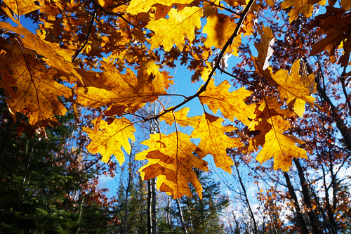
Aspen - Birch Forest: Hardwood Subtype |
|||||
 |
|||||

Slideshows |
||
| Moose Mountain SNA minnesota_snas |
||
|
||
About
Two rare plants, white baneberry and moschatel, are found here. Moschatel, the only species in its family in North America, is uncommon over most of its range, particularly with the loss of hardwood forest habitat. It prefers slopes with cold, moist air drainage. The best example of old growth hardwoods is on the south side of the power line, just over the top of the hill. The area upslope of the old growth and to the north shows direct evidence of the wildfires of the early 1900s. |
||

Visitor Videos |
|||
Share your video of this destination. |
|||
| This button not working for you? Simply email us at info@MinnesotaSeasons.com. Attach a video, a YouTube link, or a cloud storage link. |
|||
Other Videos |
|||

Visitor Sightings |
||||||||||||||||||||||||||||||||
Share your sightings or comments about of this destination. |
||||||||||||||||||||||||||||||||
| This button not working for you? Simply email us at info@MinnesotaSeasons.com. |
||||||||||||||||||||||||||||||||
MinnesotaSeasons.com Sightings |
||||||||||||||||||||||||||||||||
|
||||||||||||||||||||||||||||||||
Plants |
||||||||||||||||||||||||||||||||
Minnesota Biodiversity Atlas and Minnesota Biological Survey Vegetation Releves Plant List |
||||||||||||||||||||||||||||||||
Plants frequently found in: Aspen - Birch Forest: Hardwood Subtype FDn43b2 Black Ash - Aspen - Balsam Poplar Swamp (Northeastern) WFn55a Red Oak - Sugar Maple - Basswood - (Bluebead Lily) Forest MHn35b |
||||||||||||||||||||||||||||||||
 |
||||||||||||||||||||||||||||||||

Created: Last Updated: © MinnesotaSeasons.com. All rights reserved. |