Sugarloaf Point SNA
About • Location • Activities • Ecology
About |
||
Ownership |
||
|
||
Links |
||
Overview |
||
|
||
History |
||
|
||
Management |
||
|
||
Comments |
||
|
||
Driving Directions |
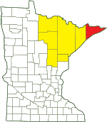 |
|||||
| Cook County | ||||||
| Northeast Minnesota | ||||||
Activities |
||
Hiking Trails |
||
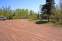
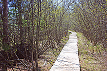
The Sugarloaf Cove Nature Center Interpretive Trail begins at the parking area and passes through the SNA. In order to protect the fragile vegetation on the site visitors are asked to not walk out to Sugarloaf Point. |
||
Hunting |
||
No hunting |
||
Ecology |
|||||||
Ecological Classification |
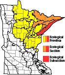 |
||||||
| Ecological Province | Laurentian Mixed Forest |
||||||
| Ecological Section | Northern Superior Uplands |
||||||
| Ecological Subsection | North Shore Highlands |
||||||
| Land Type Association | North Shore Till Plain |
||||||
Native Plant Communities* |
|||||||
Aspen - Birch Forest: Balsam Fir Subtype Dry Bedrock Shore (Lake Superior) Gravel/Cobble Beach (Lake Superior) Upland White Cedar Forest Wet Rocky Shore (Lake Superior): Bedrock Subtype |
|||||||
| * Source: The Minnesota Biological Survey, Minnesota Department of Natural Resources, Division of Ecological Resources | |||||||
Natural Features |
|||||||
|
|||||||

Visitor Videos |
|||
Share your video of this destination. |
|||
| This button not working for you? Simply email us at info@MinnesotaSeasons.com. Attach a video, a YouTube link, or a cloud storage link. |
|||
Other Videos |
|||
| Sugarloaf Point Scientific and Natural Area Virtual Hike Minnesota Department of Natural Resources |
|||
About
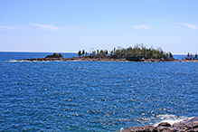
Jun 11, 2020 Sugarloaf Point SNA was once an island. It became connected to the mainland over time as beach sediment accumulated to bridge the gap. This is called a tombolo! Even if you do not visit this SNA in person, it is rewarding to know that we, as Minnesotans, have together protected this important habitat for the rare and wild in Minnesota. mndnr.gov/snas/sna01069 |
|||

Visitor Sightings |
||||||||||||||||||||||||||||||||
Share your sightings or comments about of this destination. |
||||||||||||||||||||||||||||||||
| This button not working for you? Simply email us at info@MinnesotaSeasons.com. |
||||||||||||||||||||||||||||||||
MinnesotaSeasons.com Sightings |
||||||||||||||||||||||||||||||||
|
||||||||||||||||||||||||||||||||
Birds |
||||||||||||||||||||||||||||||||
|
||||||||||||||||||||||||||||||||
Plants |
||||||||||||||||||||||||||||||||
|
||||||||||||||||||||||||||||||||
Minnesota Biodiversity Atlas and Minnesota Biological Survey Vegetation Releves Plant List |
||||||||||||||||||||||||||||||||
Plants frequently found in: Aspen - Birch Forest: Balsam Fir Subtype FDn43b1 Dry Bedrock Shore (Lake Superior) LKu43a Gravel/Cobble Beach (Lake Superior) LKu32e |
||||||||||||||||||||||||||||||||
Created: Last Updated: © MinnesotaSeasons.com. All rights reserved. |
