Superior Hiking Trail
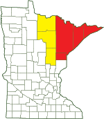
Location |
||||||||||||||||||||||||||||||||||||||||||||||||||
|
||||||||||||||||||||||||||||||||||||||||||||||||||
Sections (south to north) |
||||||||||||||||||||||||||||||||||||||||||||||||||
Southern Terminus to Martin Rd Trailhead SHT Area 1 Minnesota-Wisconsin Border to Wild Valley Road Trailhead Wild Valley Road Trailhead to Jay Cooke State Park Visitor Center Jay Cooke State Park Visitor Center to Grand Portage Trailhead Grand Portage Trailhead to 131st Avenue W. (Fond Du Lac) Trailhead 131st Avenue W. (Fond Du Lac) Trailhead to 123rd Avenue W. (Becks Road) Trailhead 123rd Avenue W. (Becks Road) to Magney Snively Trailhead Magney Snively Trailhead to Spirit Mountain Grand Avenue Chalet Trailhead Spirit Mountain Grand Avenue Chalet Trailhead to Waseca Street Trailhead Waseca Street Trailhead to Skyline Parkway Trailhead Skyline Parkway Trailhead to N. 24th Avenue W. Trailhead N. 24th Ave W. Trailhead to Twin Ponds Trailhead Twin Ponds Trailhead to Rose Garden Trailhead Rose Garden Trailhead to Hartley Nature Center Trailhead Hartley Nature Center Trailhead to Martin Road Trailhead Martin Rd Trailhead to Lake County Rd 301 (Fors Rd) Trailhead SHT Area 2 Martin Road Trailhead to Lismore Road Lismore Road to Normanna Road Trailhead Normanna Road Trailhead to Western Fox Farm Road (Sucker River) Trailhead Western Fox Farm Road (Sucker River) Trailhead to Eastern Fox Farm Road Trailhead Eastern Fox Farm Road Trailhead to Rossini Road Trailhead Rossini Road Trailhead to Lake County Demonstration Forest Trailhead Lake County Demonstration Forest Trailhead to Reeves Road Trailhead Reeves Road Trailhead to Lake County Road 301 Trailhead Lake County Rd 301 (Fors Rd) To Minnesota Highway 1 Trailhead SHT Area 3 Lake County Road 301 to Castle Danger SHT Area 3 Section 1 Castle Danger to Gooseberry Falls State Park SHT Area 3 Section 2 Gooseberry Falls State Park to Split Rock River Wayside SHT Area 3 Section 3 Split Rock River Loop at Split Rock River Wayside SHT Area 3 Section 4 Split Rock River Wayside to Beaver Bay SHT Area 3 Section 5 Beaver Bay to Silver Bay SHT Area 3 Section 6 Silver Bay to Tettegouche State Park and Highway 1 SHT Area 3 Section 7 Highway 1 Trailhead to Temperance River Wayside Trailhead SHT Area 4 Highway 1 to Lake County Road 6 SHT Area 4 Section 1 Lake County Road 6 to Lake County Road 7 SHT Area 4 Section 2 Lake County Road 7 to Crosby-Manitou State Park SHT Area 4 Section 3 Crosby-Manitou State Park to Caribou Falls State Wayside SHT Area 4 Section 4 Caribou Falls State Wayside to Cook County Road 1 SHT Area 4 Section 5 Cook County Road 1 to Temperance River State Park SHT Area 4 Section 6 Temperance River Wayside Trailhead to Pincushion Mountain Trailhead SHT Area 5 Temperance River State Park to Britton Peak Britton Peak to Oberg Mountain Oberg Mountain to Lutsen Mountains Recreation Area Lutsen Mountains Recreation Area to Caribou Trail Caribou Trail to Cascade River State Park Cascade River State Park to Bally Creek Road Bally Creek Road to Grand Marais Pincushion Mountain Trailhead to Northern Terminus SHT Area 6 Grand Marais to Cook County Road 58 SHT Area 6 Section 1 Cook County Road 58 to Kadunce River Wayside SHT Area 6 Section 2 Kadunce River State Wayside to Judge C.R. Magney State Park SHT Area 6 Section 3 Judge C.R. Magney State Park to County Road 70 SHT Area 6 Section 4 County Road 70 to Arrowhead Trail SHT Area 6 Section 5 Arrowhead Trail to Jackson Lake Road SHT Area 6 Section 6 Jackson Lake Road to Otter Lake Road SHT Area 6 Section 7 Otter Lake Road to Northern Terminus/270 Degree Overlook SHT Area 6 Section 8 |
||||||||||||||||||||||||||||||||||||||||||||||||||
Parking |
||||||||||||||||||||||||||||||||||||||||||||||||||
Superior Hiking Trail Wild Valley Rd. Trailhead |
||||||||||||||||||||||||||||||||||||||||||||||||||
Maps |
||||||||||||||||||||||||||||||||||||||||||||||||||
Guidebooks and maps are available for purchase through the Superior Hiking Trail Association. - - - - - - - - - - - - - - - - The Trail Atlas of the Superior Hiking Trail, a comprehensive map set for the entire Superior Hiking Trail, is available for purchase in digital format for use in the Avenza Maps app on IOS and Android. Trail Atlas of the Superior Hiking Trail - - - - - - - - - - - - - - - - The Superior Hiking Trail Databook contains no maps but it has mileages between campsites, water sources, overlooks, and other points of interest on the trail. It is available for purchase through the Superior Hiking Trail Association. |
||||||||||||||||||||||||||||||||||||||||||||||||||
About |
||
Overview |
||
|
||
Ownership and Management |
||
 |
||
Links |
||
|
||
Fees |
||
No fee |
||
Season |
||
June to February The trail may be closed for two weeks each November during deer hunting season. People are asked to stay off trails during spring thaw, which is from March to May. Trails are muddy or saturated at this time, and are particularly sensitive to damage. |
||
Activities |
||
Hiking Trail running Snowshoeing Backpacking |
||
Length |
||
300 miles |
||
Surfaces |
||
|
||
Created: 12/7/2023 Last Updated: © MinnesotaSeasons.com. All rights reserved. |
