![]()
![]()
![]()
![]()
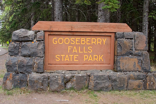
Gooseberry Falls State Park
About • Location • Activities • Ecology
About |
Ownership |
|
Links |
Overview |
|
History |
|
Management |
|
Comments |
|
Location |
||||||||||||||||||||||||||||||
Size |
||||||||||||||||||||||||||||||
1,682 acres statutory, 1,661 owned |
||||||||||||||||||||||||||||||
Driving Directions |
||||||||||||||||||||||||||||||
|
||||||||||||||||||||||||||||||
Parking |
||||||||||||||||||||||||||||||
3206 Highway 61 East N47 8.421, W91 28.173 |
||||||||||||||||||||||||||||||
Hours |
||||||||||||||||||||||||||||||
Daily from 8 a.m. until 10 p.m. |
||||||||||||||||||||||||||||||
Fees |
||||||||||||||||||||||||||||||
Daily park permit: $7 Annual park permit: $35 |
||||||||||||||||||||||||||||||
Maps |
||||||||||||||||||||||||||||||

Activities |
||||||||||||||||||||
Hiking Biking Mountain biking Horseback riding Picnicking Camping Backpacking Rock climbing and bouldering Swimming Boating Canoeing Birding Nature photography Geocaching Cross country skiing Skate-skiing Winter hiking Snowshoeing Snowmobiling |
||||||||||||||||||||
Trails |
||||||||||||||||||||
|
||||||||||||||||||||
Hunting and Fishing |
||||||||||||||||||||
No hunting. The park may hold one or more managed hunts in the fall. In most cases, Minnesota residents do not need a permit to fish in Minnesota State Parks. |
Ecology |
|||||
Ecological Classification |
 |
||||
| Ecological Province | Laurentian Mixed Forest Province | ||||
| Ecological Section | Northern Superior Uplands | ||||
| Ecological Subsection | North Shore Highlands | ||||
| Land Type Association | Split Rock Till Plain | ||||
Native Plant Communities* |
|||||
Alder - (Maple - Loosestrife) Swamp Aspen - Birch Forest: Hardwood Subtype Exposed Mafic Cliff (Lake Superior) Gravel/Cobble Beach (Lake Superior) Lake Superior Rocky Shore Sedge Meadow: Bluejoint Subtype Upland White Cedar Forest Wet Mafic Cliff (Northern) |
|||||
| * Source: The Minnesota Biological Survey, Minnesota Department of Natural Resources, Division of Ecological Resources | |||||
Natural Features |
|||||
|
|||||
Visitor Photos |
||
Share your photo of this destination. |
||
This button not working for you? |
||
Wayne Rasmussen |
||
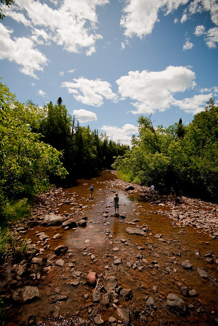
This is likely the most frequented park in Minnesota because it offers easy access, good hiking, great views and often friendly wildlife near the visitor center. |
||
 |
 |
|
MinnesotaSeasons.com Photos |
||
 |
 |
|
Park entrance |
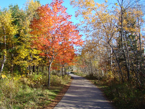
Aspen - Birch Forest: Hardwood Subtype | |
 |
 |
|
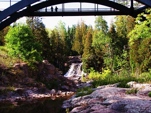
Middle Falls |
||
 |
||
Upper Falls |
||

Slideshows |
Gooseberry Falls State Park |
|
Gooseberry Falls |
|
Gooseberry Falls State Park |
|
Gooseberry Falls State Park |
|
About
Gooseberry Falls State Park |
Gooseberry Falls State Park, Minnesota |
About
Published on Oct 28, 2013 Favorite Sites: 7, 11, 17, 21, 24, 25, 32, 36, 42, 43, 44, 45, 46, 47, 60, 62, 66 |
Gooseberry Falls MN |
About
Published on Feb 10, 2014 I created this video with the YouTube Slideshow Creator |

Visitor Videos |
||
Share your video of this destination. |
||
This button not working for you? |
||
|
Other Videos |
||
A Walk in the Park: Gooseberry Falls |
About
Jun 12, 2017 Gooseberry Falls is the gateway to the North Shore. It is known for its spectacular waterfalls, river gorge, Lake Superior shoreline, Civilian Conservation Corps log and stone structures, and north woods wildlife. https://www.dnr.state.mn.us/state_parks/park.html?id=spk00172#homepage Shot & Edited by Michael Uss |
Gooseberry Falls State Park - Video Tour |
About
Uploaded on Apr 13, 2011 http://OpenRoadAdventures.biz - Take this video tour of Gooseberry Falls on the North Shore of Lake Superior in Minnesota. If you haven't been to Gooseberry Falls, you'll want to go. If you have been to Gooseberry Falls, you'll want to go back. Visit www.OpenRoadAdventures.biz for more on Gooseberry Falls State Park in Minnesota and to see our Minnesota Audio Tours. |
#31,... Gooseberry Falls State Park! MN. |
About
Uploaded on Nov 18, 2010 Just a few clips & photos of Minnesota's Gooseberry Falls! |
North Shore Camping, Fall 2009. Gooseberry Falls State Park, MN (edited version) |
About
Uploaded on Oct 1, 2009 5 guys, beer, food, hiking, lake Superior, no rain(!), campfires, music, etc. |

Visitor Sightings |
|
Share your sightings or comments about of this destination. |
|
This button not working for you? |
|
Dick Edwards |
||
Fungi and Lichens |
||
| Smoky Spindles (Clavaria fumosa) |  |
|
Lane Keller |
||
Reptiles |
||
| Ring-necked Snake (Diadophis punctatus) |  |
|
Ruth M King |
||
Mammals |
||
| Franklin’s Ground Squirrel (Poliocitellus franklinii) | ||
Becky Utecht |
||
Mammals |
||
| Franklin’s Ground Squirrel (Poliocitellus franklinii) |  |
|
MinnesotaSeasons.com Sightings |
Visits |
5/26/2011 |
Birds |
||||||||||
|
||||||||||
Fishes |
||||||||
|
||||||||
Fungi and Lichens |
||
Insects and Arachnids |
||
Plants |
||||||||||||
|
||||||||||||
Minnesota Biodiversity Atlas and Minnesota Biological Survey Vegetation Releves Plant List |
||||||||||||
Plants frequently found in: Alder - (Maple - Loosestrife) Swamp FPn73a Aspen - Birch Forest: Hardwood Subtype FDn43b2 Exposed Mafic Cliff (Lake Superior) CTu22a Gravel/Cobble Beach (Lake Superior) LKu32e Lake Superior Rocky Shore LKu43 Sedge Meadow: Bluejoint Subtype WMn82b1 |
||||||||||||
Reptiles |
||

Created: Last Updated: © MinnesotaSeasons.com. All rights reserved. |