![]()
![]()
![]()
![]()
Lost Lake Peatland SNA
About • Location • Activities • Ecology
About |
||
Ownership |
||
|
||
|
||
Only 200 acres of this site is owned by the State of Minnesota. The remainder is St. Louis County land. |
||
Links |
||
Overview |
||
|
||
History |
||
|
||
Management |
||
|
||
Comments |
||
|
||
Location |
||||
Maps |
||||
|
||||
Printable Map(s) with GPS coordinates |
||||
 |
||||
Size |
||||
2,660 acres |
||||
Parking |
||||
Park at the Lost Lake Public Water Access on the southeast shore of Lost Lake at the end of County Road 458. Lost Lake Public Water Access |
||||
Driving Directions |
 |
|||||
| St. Louis County | ||||||
| Northeast Minnesota | ||||||
Activities |
||
Hiking Trails |
||
There are no maintained hiking trails. The 135 mile Arrowhead State Trail passes through this site. The Arrowhead State Trail is primarily a snowmobile trail. Only 69 of the 135 miles are considered suitable for hiking in the summer. The trail is accessible one mile southeast of the parking area on County Road 458 where it intersects with County Road 476. However, there may be no parking spot available at that location. |
||
Hunting |
||
All hunting and trapping. See Hunting and Trapping Regulations (MN DNR) for details. |
||
Ecology |
|||||||
Ecological Classification |
 |
||||||
| Ecological Province | Laurentian Mixed Forest Province |
||||||
| Ecological Section | Northern Minnesota & Ontario Peatlands Northern Superior Uplands |
||||||
| Ecological Subsection | Border Lakes Littlefork-Vermillion Uplands |
||||||
| Land Type Association | Koochiching Peatlands Vermilion Bedrock Complex |
||||||
Native Plant Communities* |
|||||||
Not mapped (10/11/2021) |
|||||||
| * Source: The Minnesota Biological Survey, Minnesota Department of Natural Resources, Division of Ecological Resources | |||||||
Natural Features |
|||||||
Coniferous forest, featureless water track, ribbed fen, raised bog, crested raised bog, yellow birch-white cedar forest |
|||||||
GPS recommended
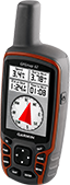
A GPS unit and detailed map are recommended.
Visitor Photos |
|||||
Share your photo of this destination. |
|||||
| This button not working for you? Simply email us at info@MinnesotaSeasons.com. Attach one or more photos and, if you like, a caption. |
|||||
|
|||||
MinnesotaSeasons.com Photos |
|||||
Parking, Lost Lake Public Water Access |
|||||
 |
 |
||||
Interpretive Sign |
|||||
 |
|||||
Wood Routed Sign |
|||||
 |
|||||
Lost Lake |
|||||
 |
|||||
Forest |
|||||
 |
 |
||||

Slideshows |
||

Visitor Videos |
|||
Share your video of this destination. |
|||
| This button not working for you? Simply email us at info@MinnesotaSeasons.com. Attach a video, a YouTube link, or a cloud storage link. |
|||
Other Videos |
|||

Visitor Sightings |
||||||||||||||||||||||||||||||||
Share your sightings or comments about of this destination. |
||||||||||||||||||||||||||||||||
| This button not working for you? Simply email us at info@MinnesotaSeasons.com. |
||||||||||||||||||||||||||||||||
MinnesotaSeasons.com Sightings |
||||||||||||||||||||||||||||||||
|
||||||||||||||||||||||||||||||||
Birds |
||||||||||||||||||||||||||||||||
Minnesota Biodiversity Atlas Birds List |
||||||||||||||||||||||||||||||||
Fishes |
||||||||||||||||||||||||||||||||
Insects and Arachnids |
||||||||||||||||||||||||||||||||
Plants |
||||||||||||||||||||||||||||||||
|
||||||||||||||||||||||||||||||||
Minnesota Biodiversity Atlas and Minnesota Biological Survey Vegetation Releves Plant List |
||||||||||||||||||||||||||||||||

Created: Last Updated: © MinnesotaSeasons.com. All rights reserved. |