![]()
![]()
![]()
![]()
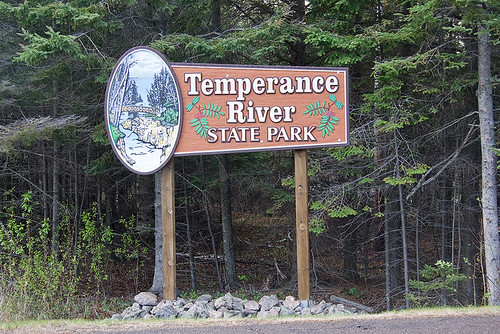
Temperance River State Park
About • Location • Activities • Ecology
About |
Ownership |
|
Links |
Overview |
|
History |
|
Management |
|
Comments |
|
Location |
||||||||||||||||||||||||||||||
Size |
||||||||||||||||||||||||||||||
5,007 acres statutory, 1,134 owned |
||||||||||||||||||||||||||||||
Driving Directions |
||||||||||||||||||||||||||||||
|
||||||||||||||||||||||||||||||
Parking |
||||||||||||||||||||||||||||||
N47 33.346, W90 52.301 |
||||||||||||||||||||||||||||||
Hours |
||||||||||||||||||||||||||||||
Daily from 8 a.m. until 10 p.m. |
||||||||||||||||||||||||||||||
Fees |
||||||||||||||||||||||||||||||
Daily park permit: $7 Annual park permit: $35 |
||||||||||||||||||||||||||||||
Maps |
||||||||||||||||||||||||||||||

Activities |
||||||||||||||
Hiking Biking Mountain biking Horseback riding Picnicking Camping Backpacking Rock climbing and bouldering Swimming Boating Canoeing Birding Nature photography Geocaching Cross country skiing Skate-skiing Winter hiking Snowshoeing Snowmobiling |
||||||||||||||
Trails |
||||||||||||||
|
||||||||||||||
Hunting and Fishing |
||||||||||||||
Approximately 600 acres of Temperance River State Park is open to public hunting but closed to trapping. The area is located north of Minnesota Hwy. 61 and adjacent to the Cross River on both sides. See Hunting and Trapping Regulations (MN DNR) for details. In most cases, Minnesota residents do not need a permit to fish in Minnesota State Parks. |
Ecology |
|||||
Ecological Classification |
 |
||||
| Ecological Province | Laurentian Mixed Forest Province |
||||
| Ecological Section | Northern Superior Uplands |
||||
| Ecological Subsection | North Shore Highlands |
||||
| Land Type Association | North Shore Till Plain Sawtooth Mountain Bedrock Complex |
||||
Native Plant Communities* |
|||||
Alder - (Maple - Loosestrife) Swamp Aspen - Birch Forest: Balsam Fir Subtype Aspen - Birch Woodland Beaver Wetland Complex Bedrock/Boulder Shore (River): Intermittent Streambed Subtype Bedrock/Boulder Shore (River): Permanent Stream Subtype Black Ash - Aspen - Balsam Poplar Swamp (Northeastern) Black Ash - Conifer Swamp (Northeastern) Clay/Mud Shore (River): Permanent Stream Subtype Crystalline Bedrock Outcrop (Northern) Crystalline Bedrock Outcrop (Northern) / Bedrock Shrubland (Inland) / Woodland Complex Felsic Cliff (Northern) / Northern Talus Complex Gravel/Cobble Beach (Lake Superior) Gravel/Cobble Beach (River): Permanent Stream Subtype Jack Pine Woodland (Bedrock) Lowland White Cedar Forest (North Shore) Mesic Felsic Cliff (Northern) Mesic Mafic Cliff (Northern) Mesic Mafic Cliff (Northern) / Northern Talus Complex Northern Terrace Forest Northern Wet Meadow / Carr Paper Birch - Sugar Maple Forest (North Shore) Poor Tamarack - Black Spruce Swamp Rich Black Spruce Swamp (Basin) Sugar Maple Forest (North Shore) Upland White Cedar Forest White Cedar Swamp (Northeastern) White Cedar - Yellow Birch Forest Willow - Dogwood Shrub Swamp Young Forest Complex |
|||||
| * Source: The Minnesota Biological Survey, Minnesota Department of Natural Resources, Division of Ecological Resources | |||||
Natural Features |
|||||
|
|||||
Visitor Photos |
||
Share your photo of this destination. |
||
This button not working for you? |
||
Wayne Rasmussen |
||
 |
 |
|
 |
||
MinnesotaSeasons.com Photos |
||
 |
||
Park entrance |
||
 |
 |
|
Temperance River |
||

Slideshows |
Temperance River State Park |
|
About
Temperance River State Park |
Temperance River State Park MN |
About
Published on Feb 11, 2014 I created this video with the YouTube Slideshow Creator |
Temperance River State Park, Minnesota |
About
Published on Oct 30, 2013 Favorite Sites: 1, 2, 5, 15, 17, 18, 19, 20, 22, 25, 26, 28, 37, 40, 44, 46 |

Visitor Videos |
||
Share your video of this destination. |
||
This button not working for you? |
||
|
Other Videos |
||
Hiking Temperance River State Park in Minnesota |
About
Oct 18, 2018 Hiking the Temperance River State Park in Minnesota for our annual family hiking trip takes us to a great state park that we can't wait to get back to! The weather hampered some filming, so I apologize the limited footage in advance. Temperance River State Park is truely a gem along the Minnesota Northshore. |
TEMPERANCE RIVER STATE PARK | Hiking & Waterfalls | Minnesota’s North Shore on Lake Superior |
About
Jul 21, 2020 TEMPERANCE RIVER STATE PARK | Hiking & Waterfalls | Minnesota’s North Shore on Lake Superior Temperance River State Park is so unique and one of my favorite state parks on Minnesota’s North Shore. The river flows deep within a gorge which makes the hiking trails so great because the waterfall trails run right along the river gorge. There are several small falls along the length of the gorge. It's an easy hike to go along the river and see the water churning. You do not need to pay to enter the state park if you park along highway 61—so be sure to stop and enjoy the beautiful views and great hikes! If you want to see more vlogs like this be sure to give this a thumbs up! Xoxo Jeanie |
TEMPERANCE RIVER STATE PARK | Hiking & Waterfalls | Minnesota’s North Shore on Lake Superior |
About
Oct 20, 2021 TEMPERANCE RIVER STATE PARK | Hiking & Waterfalls | Minnesota’s North Shore on Lake Superior #lakesuperior #greatlakes #northshore Another stop along the North Shore. This time we visit The Temperance River State Park. We do a little hiking and check out the cool waterfall! |
Temperance River State Park Walking Trails and Water Features |
About
Sep 12, 2020 |
Temperance River State Park |
About
Uploaded on Sep 6, 2011 Walk up to the falls area. |
5 Temperance River State Park, Minnesota |
About
Published on May 31, 2013 |

Visitor Sightings |
|
Share your sightings or comments about of this destination. |
|
This button not working for you? |
|
Kathy Ross |
||
Plants |
||
bluebead lily (Clintonia borealis) western spotted coralroot (Corallorhiza maculata var. occidentalis) |
 |
|
Luciearl |
||
Plants |
||
 |
||
MinnesotaSeasons.com Sightings |
Visits |
5/26/2011 |
Birds |
||||||||||
|
||||||||||
Fishes |
||
Fungi and Lichens |
||||||||||||
|
||||||||||||
Insects and Arachnids |
||
|
||
Mammals |
||||||||
|
||||||||
Reptiles |
||

Created: Last Updated: © MinnesotaSeasons.com. All rights reserved. |