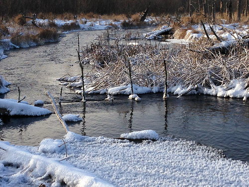
La Salle Lake SNA
About • Location • Activities • Ecology
About |
||
Ownership |
||
|
||
Links |
||
Overview |
||
|
||
History |
||
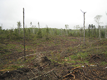
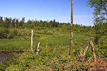
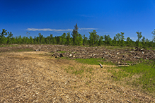
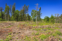
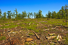
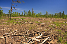
La Salle Lake SNA was designated June 27, 2011. It is part of the La Salle Lake State Recreational Area. On July 2, 2012, a severe thunderstorm went through Clearwater and Hubbard Counties. Itasca State Park, La Salle Lake SNA, and La Salle Lake State Recreational Area were all in the path of the thunderstorm. The storm brought straight line winds with speeds in excess of 80 miles per hour. Especially hard hit was the jack pine forest in this SNA southwest of the confluence of the Mississippi River and LaSalle Creek. In this area almost every tree was uprooted or snapped. A year later, in June, 2013, most of the fallen trees have been removed but a few remain. The fallen trees, along with tree stumps and large branches, litter the ground over what remains a large debris field. Plant species usually found only in woodlands, including round-lobed hepatica, wild sasparilla, and Canada mayflower, grow in this area with no overstory. Nature has years of decomposition and revegetation work to accomplish here. Until then, visitors will stumble over debris concealed under a fresh understory of early successional species. |
||
Management |
||
|
||
Comments |
||
|
||
Location |
||||
Maps |
||||
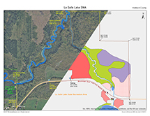
Printable Map(s) with GPS coordinates |
||||
 |
||||
Size |
||||
268.7 acres |
||||
Parking |
||||
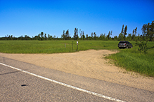
N47 20.983, W95 10.381 N47 20.970, W95 10.613 |
||||
Driving Directions |
 |
|||||
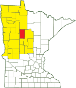
| Hubbard County | ||||||
| Northwest Minnesota | ||||||
Activities |
||
Hiking Trails |
||
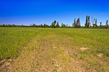
A short mowed trail (in 2013) leads from the parking area northwest to an overlook with a partially obstructed view. |
||
Hunting |
||
All hunting and trapping. See Hunting and Trapping Regulations (MN DNR) for details. |
||
Ecology |
|||||||
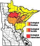
Ecological Classification |
 |
||||||
| Ecological Province | Laurentian Mixed Forest Province |
||||||
| Ecological Section | N. Minnesota Drift & Lake Plains |
||||||
| Ecological Subsection | Chippewa Plains |
||||||
| Land Type Association | Becida Till Plain |
||||||
Native Plant Communities* |
|||||||
Central Rich Dry Pine Woodland Jack Pine - (Bush Honeysuckle) Woodland: Bracken Subtype Red Pine - White Pine Forest Red Pine - White Pine Woodland: Balsam Fir Subtype Sedge Meadow White Cedar Swamp (Northcentral) Willow - Dogwood Shrub Swamp |
|||||||
| * Source: The Minnesota Biological Survey, Minnesota Department of Natural Resources, Division of Ecological Resources | |||||||
Natural Features |
|||||||
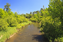
Glacial tunnel valley, LaSalle Creek, and undisturbed natural shore of the Mississippi River. |
|||||||
Overlooks
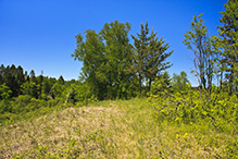
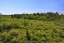
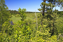
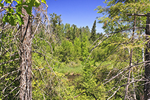
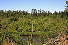
Several places along the bluff on the south side of the Mississippi River valley provide a scenic but obstructed view of the Mississippi River valley. There is a spectacular, unobstructed overlook at the northernmost point of the bluff. The La Salle Lake State Recreational Area map shows a hiking trail leading from the parking area to this overlook. In June 2013 the trail was not discernible on the ground.
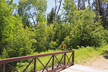
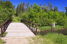
Mississippi River Footbridge
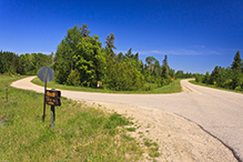
Coffeepot Landing, a public canoe access, is adjacent to this SNA. It includes a footbridge across the Mississippi River.
Visitor Photos |
|||||
Share your photo of this destination. |
|||||
| This button not working for you? Simply email us at info@MinnesotaSeasons.com. Attach one or more photos and, if you like, a caption. |
|||||
Crystal Boyd |
|||||
 |
 |
||||
 |
|||||
MinnesotaSeasons.com Photos |
|||||
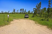
East Parking |
|||||
 |
 |
||||
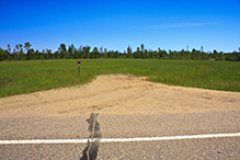
West Parking |
|||||
 |
|||||
Mowed Trail |
|||||
 |
|||||
Coffeepot Landing |
|||||
 |
 |
||||
 |
|||||
Mississippi River |
|||||
 |
|||||
Scenic Overlook |
|||||
 |
 |
||||
 |
|||||
Obstructed Overlooks |
|||||
 |
 |
||||
 |
|||||
Debris Fields, 2013 |
|||||
 |
 |
||||
 |
 |
||||


Visitor Videos |
|||
Share your video of this destination. |
|||
| This button not working for you? Simply email us at info@MinnesotaSeasons.com. Attach a video, a YouTube link, or a cloud storage link. |
|||
Other Videos |
|||
| La Salle Lake Scientific and Natural Area Virtual Hike Minnesota Department of Natural Resources |
|||
About
Dec 4, 2020 La Salle Lake SNA is part of a larger landscape recognized for many years as an exceptional place. The clear-running LaSalle Creek meanders north at the base of a steep-sided glacial tunnel valley. Fed by seeps and springs, the stream flows through many high-quality plant communities such as red pine-white pine forest, white cedar swamp, sedge meadows and willow-dogwood shrub swamps before joining the Mississippi River downstream of the popular Coffee Pot canoe landing. mndnr.gov/snas/sna02056 |
|||
| Sloughpumper La Salle Lake Scientific & Natural Area blowdown |
|||
About
Published on Jul 5, 2012 Winds of over 80 mph leveled a jack pine forest in northwestern Minnesota durning a severe thunderstorm on July 2, 2012. |
|||
| Sloughpumper A Walk in the La Salle Lake Scientific & Natural Area blowdown |
|||
About
Published on Jul 5, 2012 A short but difficult walk in the tangled aftermath of the July 2, 2012 wind storm that struck parts of northwestern Minnesota, including the La Salle Lake Scientific and Natural Area where this video was taken three days after the storm. |
|||

Created: Last Updated: © MinnesotaSeasons.com. All rights reserved. |

