![]()
![]()
![]()
![]()
Jay Cooke State Park
About • Location • Activities • Ecology
About |
Ownership |
|
Links |
Overview |
|
History |
Flooding on June 20, 2012, caused extensive damage to MN Highway 210, which provides access to the north part of the park, and to the swinging pedestrian bridge across the St. Louis River, which provides access to the trails in the south part of the park. The park was closed from June 20 to October 22, 2012. |
Management |
|
Comments |
|
Location |
||||||||||||||||||||||||||||||
Size |
||||||||||||||||||||||||||||||
8,938 acres statutory, 7,893 owned |
||||||||||||||||||||||||||||||
Driving Directions |
||||||||||||||||||||||||||||||
|
||||||||||||||||||||||||||||||
Parking |
||||||||||||||||||||||||||||||
Visitor Center N46 39.274, W92 22.330 |
||||||||||||||||||||||||||||||
Hours |
||||||||||||||||||||||||||||||
Daily from 8 a.m. until 10 p.m. |
||||||||||||||||||||||||||||||
Fees |
||||||||||||||||||||||||||||||
Daily park permit: $7 Annual park permit: $35 |
||||||||||||||||||||||||||||||
Maps |
||||||||||||||||||||||||||||||

Activities |
||||||||||||||||||||
Hiking Biking Mountain biking Horseback riding Picnicking Camping Backpacking Rock climbing and bouldering Swimming Boating Canoeing Birding Nature photography Geocaching Cross country skiing Skate-skiing Winter hiking Snowshoeing Snowmobiling |
||||||||||||||||||||
Trails |
||||||||||||||||||||
|
||||||||||||||||||||
Hunting and Fishing |
||||||||||||||||||||
No hunting. The park may hold one or more managed hunts in the fall. In most cases, Minnesota residents do not need a permit to fish in Minnesota State Parks. |
Ecology |
|||||
Ecological Classification |
 |
||||
| Ecological Province | Laurentian Mixed Forest Province |
||||
| Ecological Section | Northern Superior Uplands |
||||
| Ecological Subsection | Glacial Lake Superior Plain |
||||
| Land Type Association | Douglas Lake-Modified Till Plain Duesler Lake Plain Highland Moraine Nickerson Moraine |
||||
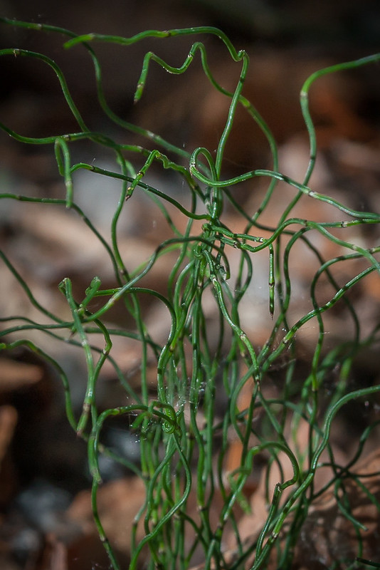
Native Plant Communities* |
|||||
Alder - (Maple - Loosestrife) Swamp Alder Swamp / Northern Sedge Meadow Complex Aspen - Ash Forest Aspen - Birch Forest Aspen - Birch - Basswood Forest Aspen - Fir Forest Beaver Wetland Complex Bedrock/Boulder Shore (River): Permanent Stream Subtype Black Ash - Aspen - Balsam Poplar Swamp (Northeastern) Black Ash - Basswood Forest Black Ash - Conifer Swamp (Northeastern) Black Ash - Mountain Maple Swamp (Northern) Black Ash - Silver Maple Terrace Forest Gravel/Cobble Beach (River): Permanent Stream Subtype Lowland White Cedar Forest (North Shore) Northern Wet Ash Swamp Red Oak - Sugar Maple - Basswood - (Bluebead Lily) Forest Red Pine - White Pine Woodland (Eastcentral Bedrock) Red Pine - White Pine Woodland: Balsam Fir Subtype Red Pine - White Pine Woodland: Mountain Maple Subtype River / Rocky Shore Complex Sedge Meadow Slumping Clay/Mud Slope (River) Sugar Maple - Basswood - (Bluebead Lily) Forest Thomson Outcrop / Cliff / Woodland Complex Upland White Cedar Forest White Cedar Swamp (Northeastern) White Pine - White Spruce - Paper Birch Forest Willow - Dogwood Shrub Swamp |
|||||
| * Source: The Minnesota Biological Survey, Minnesota Department of Natural Resources, Division of Ecological Resources | |||||
Natural Features |
|||||
|
|||||
Visitor Photos |
||
Share your photo of this destination. |
||
This button not working for you? |
||
Wayne Rasmussen |
||
 |
||
MinnesotaSeasons.com Photos |
||
 |
||
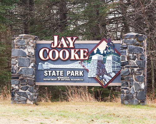
Park entrance |
||
 |
 |
|
Suspension bridge |
||
 |
 |
|
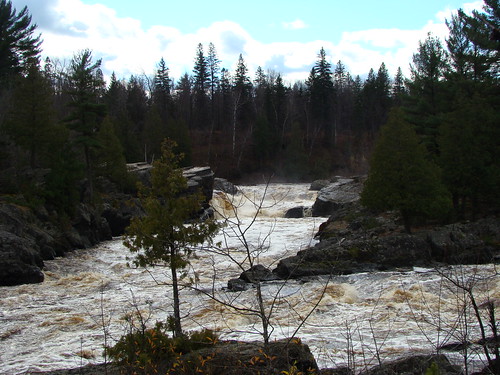
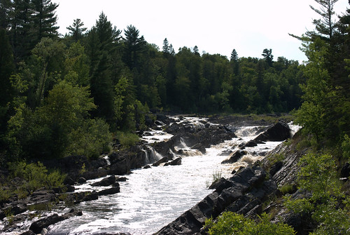
St. Louis River |
||
 |
 |
|
Rapids |
||

Slideshows |
Jay Cooke State Park |
|
Jay Cooke State Park |
|
Jay Cooke |
|
Jay Cooke State Park |
|
About
Jay Cooke State Park,, MN |
Jay Cooke State Park, Minnesota |
About
Published on Oct 29, 2013 Favorite Sites: 1, 3, 14, 21, 33, 37, 40, 43, 45, 61, 65, 70, 76, 77 |

Visitor Videos |
||
Share your video of this destination. |
||
This button not working for you? |
||
|
Other Videos |
||
A Walk in the Park: Jay Cooke State Park |
About
Jun 12, 2017 Trailblazers: this park is a must! Perfect for backpackers, bikers, hikers, horseback riders, and skiers. Walk on the swinging suspension bridge high above the raging St. Louis River, check out the wildflowers in the spring, and the vivid colors in the fall. https://www.dnr.state.mn.us/state_parks/park.html?id=spk00187#homepage Shot & Edited by Michael Uss |
Jay Cooke State Park Tour - Minnesota North Shore |
About
Uploaded on May 23, 2011 http://OpenRoadAdventures.biz - Video tour of Jay Cooke State Park, it's awesome suspension bridge and waterfalls. Jay Cooke is located along the North Shore Highway on the Shores of Lake Superior in Minnesota |
St. Louis River raging after record rainfall |
About
Published on Jun 23, 2012 Swinging bridge at Jay Cooke State Park getting beat up by the St. Louis River. |

Visitor Sightings |
|
Share your sightings or comments about of this destination. |
|
This button not working for you? |
|
Megan and Rob Szymczak |
||
Fungi and Lichens |
||
| Fly Agaric (Amanita muscaria) |  |
|
MinnesotaSeasons.com Sightings |
Visits |
5/25/2010 7/15/2014 |
Amphibians |
||
Birds |
||||||||||||
|
||||||||||||
Minnesota Biodiversity Atlas Birds List |
||||||||||||
Blue Jay (Cyanocitta cristata) Common Yellowthroat (Geothlypis trichas) |
 |
|||||||||||
Fishes |
||
Fungi and Lichens |
||
| Crown Rust (Puccinia coronata) |  |
|


Mammals |
||
| American Red Squirrel (Tamiasciurus hudsonicus) |  |
|


Reptiles |
||

Created: Last Updated: © MinnesotaSeasons.com. All rights reserved. |